


 24/7 Emergency Service
NOAA METEOROLOGIST BOB CASE, THE MAN WHO NAMED THE PERFECT STORM
8/3/2017 (Permalink)
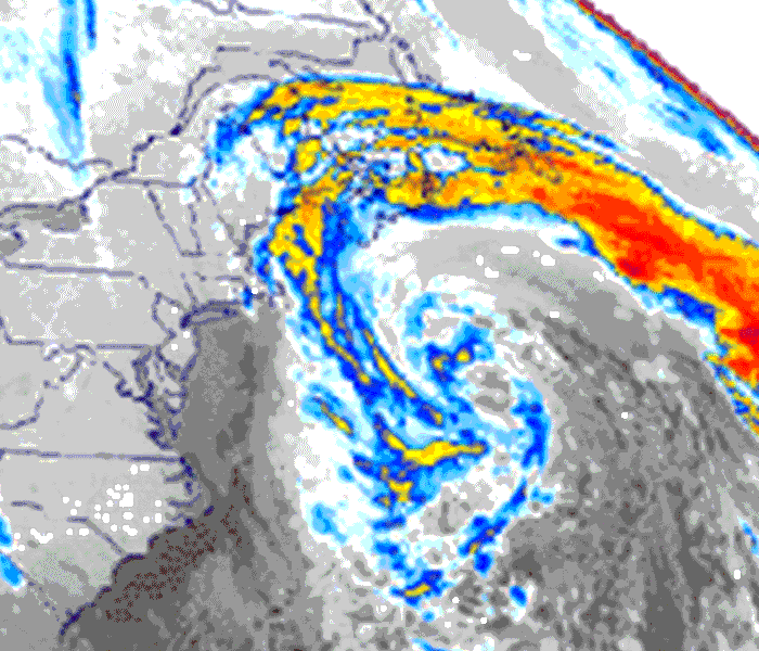 Radar picture of the storm.
June 16, 2000 — The conditions were "perfect" for a monstrous storm, a meteorological time bomb that would explode in the northern Atlantic Ocean creating waves ten stories high and imperiling the New England fleet. This was the assessment of Bob Case, a NOAA National Weather Service meteorologist at the Boston, Mass. forecast office, who, with his weather service colleagues in late October 1991, began warning the public of a storm that would take on epic proportions.
"It was an unprecedented set of circumstances," the now-retired weatherman said. "A strong disturbance associated with a cold front moved along the U.S.-Canadian border on October 27 and passed through New England pretty much without incident. At the same time, a huge high pressure system was forecast to build over southeast Canada. When a low pressure system along the front moved into the Maritimes southeast of Nova Scotia, it began to intensify due to the cold dry air introduced from the north," according to Case.
"These circumstances alone, could have created a strong storm," Case said. "But then, like throwing gasoline on a fire, a dying hurricane Grace delivered immeasurable tropical energy to create the perfect storm."
With all of the contributing factors coming together at just the right time, in less than 24 hours, the storm exploded to epic proportions and then headed toward the coast," the meteorologist said, adding that if any of the components were out of sync, the epic storm would not have happened."
While NOAA's National Weather Service was warning of a storm of huge proportions, New England was enjoying unusually nice weather for late October—a beautiful late autumn day with plenty of sunshine and a northeast breeze, Case explained. "There was a certain amount of skepticism to our warnings of what turned out to be one of the North Atlantic's most powerful storms."
One of Case's colleagues at the Boston office was Walt Drag, a forecaster who shared his passion for meteorology. "Walt had a good handle on it early and the office put out warnings of a big storm," Case said. "This is an area well known for breeding tremendous storms and we could see it coming together on the satellite images and computer model information from the national center in Washington."
"You knew something bad was going to happen," said Ross Dickman another NWS meteorologist who worked the storm. "I remember seeing waves crashing over the seawall at Winthrop (Mass.) sending spray a hundred feet into the air. It was incredible."
An interesting aspect of the huge system was its retrograde motion not away from the New England Coast, but toward it. "It was difficult for us to convey the magnitude of the event to the public," Case said. "Not too many people could fathom–or believe–100-foot waves and hurricane force winds, 70-80 miles-per-hour plus, in a storm that was heading from east to west. "You were looking at a set of meteorological circumstances that come together maybe every 50-100 years."